
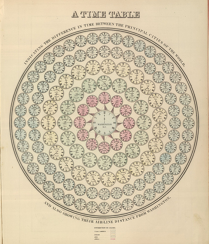
This image shows all the times in the different principle cities of the world and also their airline distance
from the city of Washington


These images where taken from a document containing 70 detailed maps of the known universe that had all been engraved into steel plates for mass production. The amount of time and effort gone into this project would have been absolutely monumental considering the time in which they where produced.
The amazing amount of detail on each page is also delivered with clear precision and scale.

This is a fold out print depicting all of human history from creation. Vignettes of historically significant people, places and buildings etc are arranged along the borders.
The designer has employed something of a metaphorical display choice. Civilizations are presented as a series of rivers, the widths likely to imply the comparative population level of each group versus the worlds population which flow down through history

This is a map that charts the world and its key features that were known during the time. It also shows the different races and varieties of the human race that were known across the empire.

Map of New York


Maps of Pennsylvania


No comments:
Post a Comment